
Role
Product Designer
Teammates
Product manager
Client
ND
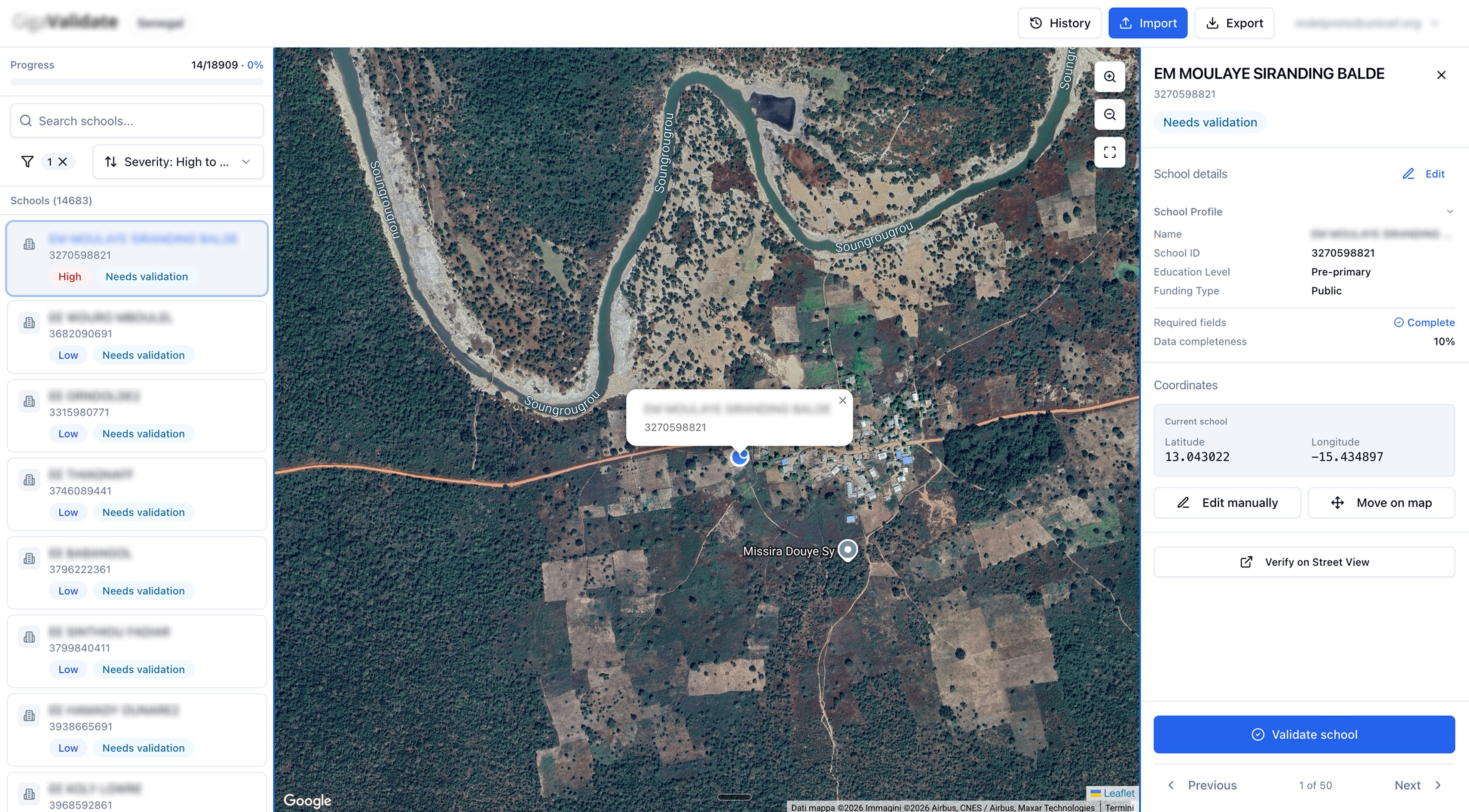
I designed and built a functional app for data validation that gives governments a self-service platform to clean and approve school data, without Excel files, without extra documentation, without back-and-forth emails.
The problem
Governments and partner organizations submit school data from all over the world. The data is often messy: wrong coordinates, unknown values, missing fields, inconsistent formats. The existing process to fix all of this relied entirely on spreadsheets passed back and forth over email. No structure, no guidance, no way to act on errors at scale.
The needs
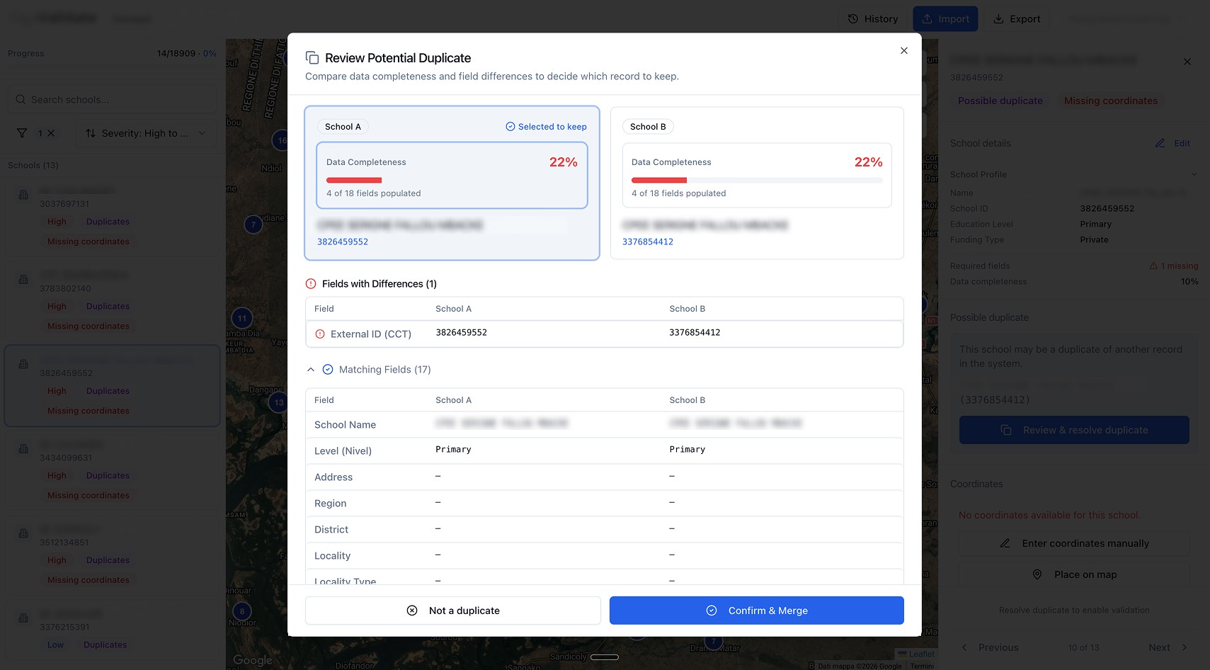
Validators needed a platform that could surface all errors in one place, let them apply bulk corrections without repeating the same action hundreds of times, and guide them through the resolution process without having to read any external documentation or reload corrected files manually. The goal was full autonomy: a government team should be able to open the tool, understand what's wrong, fix it, and submit clean data entirely on their own.
Exploration
I started by interviewing stakeholders across the data validation workflow to map where the real friction was. Then I ran a competitor analysis, both direct tools and indirect alternatives, to understand how other products approached bulk data correction beyond the classic CSV importer pattern.
From there I mapped the jobs to be done for every scenario a validator could encounter: coordinate errors, unknown values that didn't match the system's valid options, missing required fields, formatting inconsistencies. Each job became a design surface to solve.
Building it
The tool handles the full round-trip. Excel files are imported and automatically mapped to the platform schema, field types identified, errors surfaced immediately.
Coordinate validation happens visually: validators see the school pin on Google Maps HD satellite imagery.
A Gemini Pro integration screenshots the area, checks whether the structure looks like a school, and verifies that minimum required fields are complete.
If everything checks out, the record is auto-validated.
If not, it goes to manual review with a direct Google Street View link for that location.
Once done, the corrected dataset exports back as a clean Excel file, ready to submit.
Impact
Bulk resolution alone was estimated to cut validation time by around 70%.
More importantly, governments shift from reactive to proactive: every issue caught and resolved before submission, with a full audit trail that spreadsheets never had.